By: Douglas R. Clark, Director, and Kent V. Bramlett, Chief Archaeologist, La Sierra University, Riverside, CA
[photographer: Jillian Logee, Calgary, AB]
What began as a normal, and 15th, season of excavations at Tall al-`Umayri, Jordan—part of the Madaba Plains Project—turned out to be anything but normal. Land ownership issues forced the team at the last minute to change course drastically and plan as if this were the last summer excavation season ever at a site deserving another 15 or 50. While negotiations continued, theteam braced for the worst and reconfigured their entire set of objectives for, a move which pressed them to sharpen their focus, record everything digitally as if there were no tomorrow, and push themselves to the limit of what is possible in five weeks. In the end, theteam accomplished every single newly minted objective, including especially the following:
1) Accomplish several things archaeologically (in chronological order):
a. Complete recording of Early Bronze Age dolmen
b. Clarify buildings of the Early Iron I settlement along the western perimeter wall by exposing the fourth contiguous structure (Building D) in a row
c. Sort out pre- and post-earthquake phases of the buildings in this Early Iron I settlement
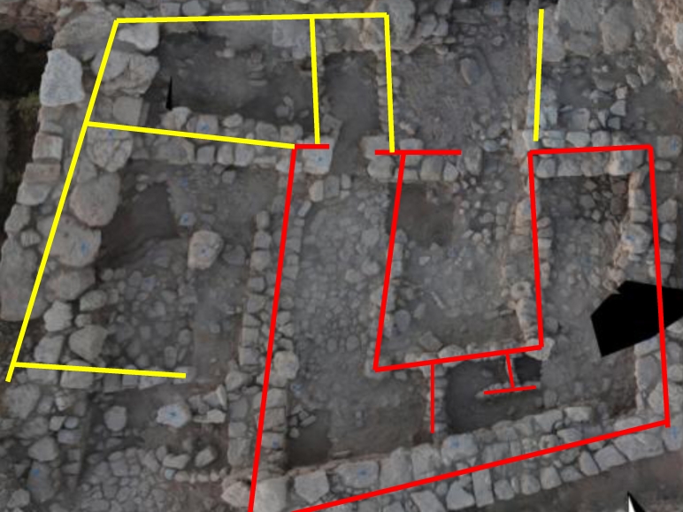
d. Expose a slightly later “four-room” building plan plus surrounding attached rooms and connect this stratigraphically with the Early Iron I settlement
e. Further clarify Iron II and Iron II/Persian remains
2) Document absolutely everything possible with all the technology available should the team not be able to return
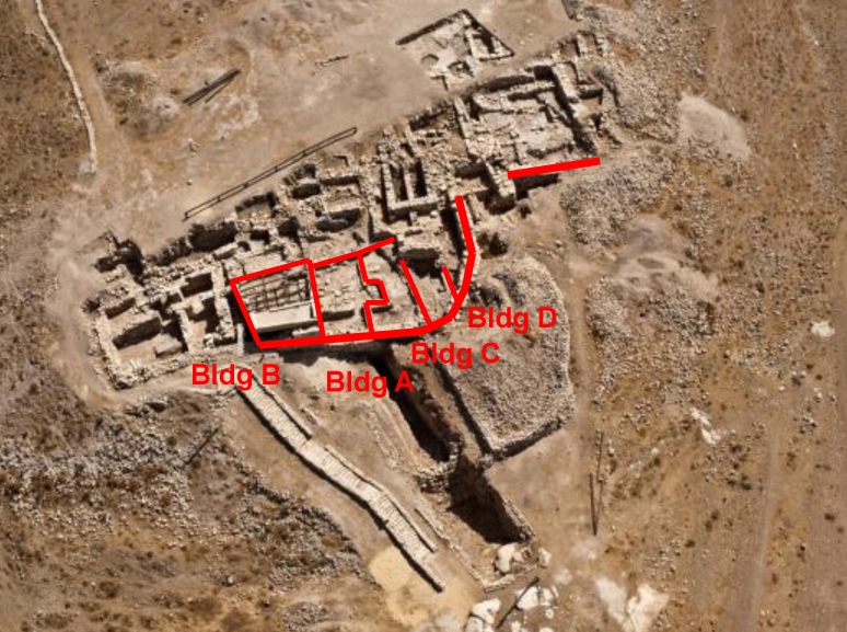
An aerial view of the tell (fig. 4—David Kennedy) displays active fields. This report will treat discoveries chronologically, beginning with Field K, then moving to Fields A & B, H, then L.
Early Bronze Age
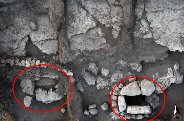
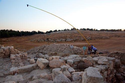
Use of a tripod-mounted photoboom (fig. 5—and see below) reveals the possible foundation of a second dolmen tomb, immediately to the west of the dolmen excavated several years ago. This might open up further excavations along the southern and eastern slopes of the tell, perhaps exposing a dolmen field.
Early Iron Age
The major focus of `Umayri excavations since the mid-1990s has been the remarkably well preserved Early Iron I settlement along the western perimeter wall, a signature feature of `Umayri. The village was likely constructed around 1250-1230, then suffered at least partial collapse due to a major earthquake in ca. 1200. Survivors immediately rebuilt their houses and repaired the western defense system using debris from the collapse (as discovered). The renovated village (fig. 6) lasted 40-50 years before succumbing to a massive assault which destroyed and burned everything, leaving a veritable time capsule, encased by the second-story mudbrick and roofing material in places 2 meters deep.
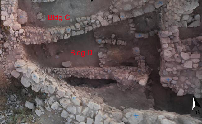
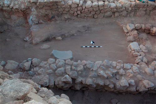
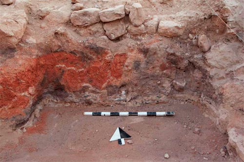
Figure 7 illustrates Buildings C (excavated) and D (completed). This photoboom shot shows the odd shape of the building, scrunched between Building C and the curving perimeter wall (lower left in the photo). The interior dividing walls on the east side of the building (right side in photo) are, for the most part, connected to the second, or post-earthquake, phase of use. Remains of the first phase can be seen in Figure 8 and extend to the eastern extent of the building beneath the dividing walls. It was upon this layer that survivors of the earthquake in ca. 1200 reconstructed their houses.
In the process of clearing Building D, excavators dug through tons of destruction debris from the final assault on the structure (fig. 9), and excavated several important artifacts, including two bronze weapon points (figs. 10 and 11), a large lamp (fig. 12), a carnelian lotus-seed pendant (fig. 13), and an exact duplicate of an impressed jar handle discovered in 1987 at `Umayri (Redford in MPP 3) with a cartouche in the center containing the name of Pharaoh Thutmose III (fig. 14).
Excavations incompleted exposure of a new structure in the southwest corner of the site in Field H (fig. 15). The building itself was constructed in a typical “four-room” plan and served a central function to a larger series of attached rooms around it on three sides. It also contained several ephemeral dividing walls in the broad room (lower part of photo), suggesting either storage or small-animal stabling. Several probes beneath the floor of the building revealed the same mudbrick detritus as covered the western buildings (fig. 16), thus providing a stratigraphic connection with the destruction of the western settlement around 1150.
Late Iron II/Persian
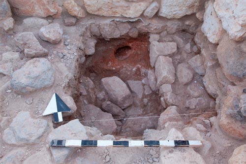
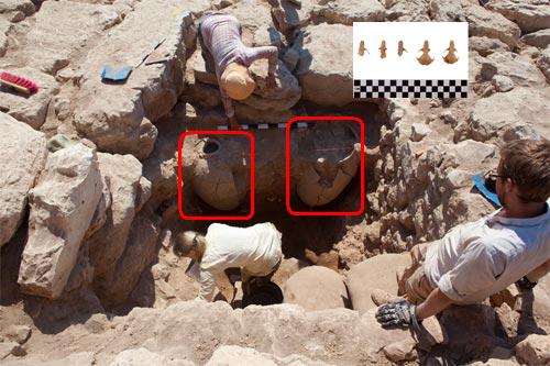
Excavations in Field L, in architecture from the Late Iron II/Persian period, produced two large adjacent pithoi or storage jars used to hold grain and other foodstuffs (fig. 17). They were interesting for two reasons: first, they came from different time periods a hundred years apart, but were used simultaneously, suggesting a long life for these food pantries, and secondly, one contained the skulls of five rats who evidently found food here, enjoyed themselves for a time, and then could not escape. This provides a graphic illustration of the intense competition for scarce resources, making the human struggle for survival truly a life-and-death matter.
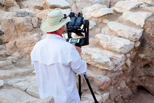
Digital Recording Technology
In keeping with the ongoing development of digital technologies at `Umayri, and especially in light of the possibility that excavation at `Umayri might end, it became apparent that the team should ramp up digital storage strategies, and add to their arsenal of digital equipment to achieve this objective. This meant continued utilization of internet resources for data acquisition and storage, the GPS mapping system, a recently introduced tripod-mounted photographic boom (fig. 18), and iPads for field supervisors (fig. 19). It also signaled the use of iPods for square supervisors, a gigapan 3-D (stereo) photographic system (fig. 20), and LiDAR (Light Detection and Ranging) measuring and imaging technology to record to within 2-3 mm all architecture at risk of loss (fig. 21).
~~~
All content provided on this blog is for informational purposes only. The American Schools of Oriental Research (ASOR) makes no representations as to the accuracy or completeness of any information on this blog or found by following any link on this blog. ASOR will not be liable for any errors or omissions in this information. ASOR will not be liable for any losses, injuries, or damages from the display or use of this information. The opinions expressed by Bloggers and those providing comments are theirs alone, and do not reflect the opinions of ASOR or any employee thereof.

